Misasin Trail
Hike Details
| Trailhead: | Misasin Trailhead |
| Hike Length: | 2.4 km |
| Route Type: | Loop |
| Difficulty: | Rated 36: Easy 36 / 223 |
| ⓘ Ratings Explained |
Description#
The trail name “Misasin” was coined by local geocachers. In Plains Cree, it means “rather large, but not overly large.” Consider this “out-and-back” style hike an exploratory trek rather than a leisurely stroll along a well-defined trail. There is only one long “leg” to this trail plan because the trail as marked is usually quite easy to follow; what lies beyond, not so much. The trail is seldom travelled and can get quite overgrown, especially during the summer months.
Tip
Long sleeves and long pants are highly recommended for this hike.
View route colour key
Misasin Trail Trailhead ➜ Trail Intersection
Distance: 1.2 km
Description
- Start out from the "Misasin Trail Trailhead" along the single-track trail.
- Use the "Turn northwest" waypoint to guide you.
- Along the next stretch, the trail is clear, but becomes a walk through a gauntlet of scratchy bushes. Long sleeves and long pants are essential here.
- Eventually the gauntlet ends and the trail widens.
- At the "Trail Intersection" waypoint this suggested hike ends. Past this point the trails become far fainter.
- Continue on at your own risk, using the "Trail Intersection" waypoint as a reference point in case you get disoriented.
- Return along the same trail, back to the "Misasin Trail Trailhead".
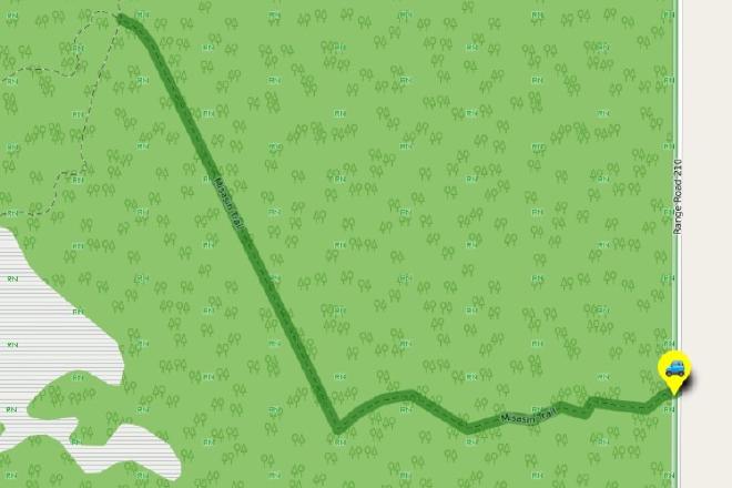
Interactive Route Map#
To see all route waypoints, zoom into the map by pinching open on mobile, scrolling on desktop.
View route colour key
Download Hike Route and Description#
Hike Route and Waypoints File#
The “.gpx” file contains both the hike route and important waypoints referred to in the hike description. See the suggestions for mobile apps and open the “.gpx” file in one of those apps on your mobile device.
Mobile (Offline) Hike Route Description in PDF Format#
Cell service can go from spotty to non-existent in the Ministik. The leg-by-leg route directions you see on this page are duplicated in a PDF document (".pdf") you can download here to read on your mobile device while offline.