Mandy Lake Parking to Oliver Lake East
Hike Details
| Trailhead: | Mandy Lake Road Gate |
| Hike Length: | 5.4 km |
| Route Type: | Out & Back |
| Difficulty: | Rated 88: Moderate 88 / 223 |
| ⓘ Ratings Explained |
Description#
This hike has all sorts of types of terrain to navigate: it starts out on a road, transitions to a fairly good trail, and ends in a meadow that you’ll need to navigate without the help of a trail. But the end goal will take you to the shoreline of a quiet lake decidedly away from civilization.
View route colour key
Mandy Lake Road Trailhead ➜ Road / Oliver Lake Trail Intersection
Distance: 608 m
Accumulated Distance: 608 m
Description
- Starting out from the parking spot at "Mandy Lake Road Trailhead", make sure you veer to the right once you pass through the gate.
- You'll wind your way along the old road and come to an intersection "Road / Oliver Lake Trail Intersection".
- Here we bear right at the intersection, leaving the road.
Road / Oliver Lake Trail Intersection ➜ Trail meets meadow
Distance: 1.3 km
Accumulated Distance: 1.908 km
Description
- The trail along this section is usually easy to follow because it's often used as a sled trail in the winter.
- The trail skirts the edge of what used to be a large body of water. These days it's a grassy area dotted with cattails.
- Make your way south to the "Trail meets meadow" waypoint where you'll come to another open meadow.
Trail meets meadow ➜ Oliver Lake Shoreline
Distance: 743 m
Accumulated Distance: 2.651 km
Description
- Continue straight ahead using the track to guide you. You'll pass through an open fence and after you do, turn right (west).
- Make your way across the open, sometimes hummocky ground until you reach the "Oliver Lake Shoreline" waypoint.
- Enjoy the solitude of the area.
- When you're ready, retrace your steps to the given waypoints in reverse order until you reach the "Mandy Lake Road Trailhead" again.
- Congratulations on exploring off the "beaten path" in the Ministik!
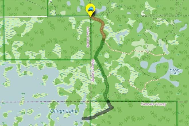
Interactive Route Map#
To see all route waypoints, zoom into the map by pinching open on mobile, scrolling on desktop.
View route colour key
Download Hike Route and Description#
Hike Route and Waypoints File#
The “.gpx” file contains both the hike route and important waypoints referred to in the hike description. See the suggestions for mobile apps and open the “.gpx” file in one of those apps on your mobile device.
Mobile (Offline) Hike Route Description in PDF Format#
Cell service can go from spotty to non-existent in the Ministik. The leg-by-leg route directions you see on this page are duplicated in a PDF document (".pdf") you can download here to read on your mobile device while offline.